
The Property Viewer is a quick and easy way to find information about a property in the City of New Orleans.
This includes addressing, zoning, and historic / conservation districts.
Political and municipal service boundaries, neighborhood, and other information are readily available in one of our other tools, Where Y'At.
If you run into any issues using this site please contact the City's GIS Department.
Show Layer List

Print (not available on mobile)

Measure

Help

Show Search Box (mobile only)
Search Box

Zoom In

Zoom Out

Locate (mobile device only)
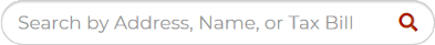
There are two primary ways to begin finding information; using the map to find a property and clicking on it, or searching by Address, Owner Name, or Tax Bill ID.
Using the map, you can zoom in and pan around until you find the area of interest.
On a desktop computer, you can zoom using the scroll-wheel on your mouse, double-clicking the left mouse button, hold down the shift key while drawing a box, or using the plus and minus buttons ( ) to zoom in or out, located in the upper-right corner of the map.
On a touchscreen device (e.g.., a mobile phone), you can double tap the map, use the pinch gesture, or use the plus and minus buttons.

Once you've found the property of interest, click inside the property (or tap, on a touchscreen device) to see the available information about the property. Once you click, the information pane will slide out from the left of the screen showing the available data. To temporarily hide the information pane, click or tap on the address name or arrow (). Click it again to re-show the information pane.
If you are on a mobile device, you can also navigate using your current location. Tap on the locate button (, just under the plus and minus zoom buttons), and the map will zoom to your current location. Make sure to allow access to location data, if your mobile device asks for it (we don't collect any location information; it is used only on your device).
When searching, begin typing the address (omit periods, so, "801 st mary", for example), owner name (use the format " "), or tax bill id into the search box (you'll need to tap the search button to show the search box on mobile). As you type, addresses and owner names will be auto-completed (tax bills are not auto-completed).
If you do not see the address or owner name you're looking for in the list of options, keep adding more information. For example, if you type "smith " while looking for an owner named John J. Smith, you may see suggestions for Smith Amanda A., Smith Amy L., etc. Keep adding letters until you see the name of the owner of interest. For common last names, you may need to type almost the entire name before you find what you're looking for.
The same rule applies for street addresses, especially for street names that begin with the same first few letters (e.g. St. Mary or St. Andrew).
After clicking or searching, there may be more than one result returned (for example, searching for an address with two owners). In this instance, you will see a list of owners at the top of the information pane. Click on one of the owner names to see the information.

At the top of the Property Information card in the information panel, there is an icon of two chain links (). Clicking or tapping this button will copy a link to your clipboard, so you can save a direct link to the property for later or share it with someone else.
LayersThe Layers list allows you to toggle the visibility of map layers. Squares, lot lines, and aerial photography are a few of your choices. The information from these layers are shown in the information panel when you select a property, even if the layer is turned off in the layers list.
PrintPrint generates a printable view of the map and information for the selected property. Using your browser, you can print a hard copy, or save a PDF version of the printout. If you've made any measurements (see below), those will appear in the printout as well. Click here to see a sample. Please note, printing is not available on mobile devices.
MeasureMeasure allows you to measure lengths and areas on the map. Please note, that these measurements are not survey grade, and are useful only as a general estimate of what the real measurements may be.
To measure a length, click or tap on the map to start, then click or tap one or more additional points along the length you'd like to measure. Double-click at the end point to finish and compute the length of the line.
To measure an area, click or tap on the map to start, then add points (at least two more) around the area you'd like to measure. Double-click at a point close to the starting point to finish and compute the area and perimeter.
On mobile devices, a "Finish" button is available; use that instead of double-clicking to finish measuring and compute the length or area.
You can have as many measurements on the map at one time as you'd like. Click the "Clear Measurements" button at the bottom of the Measurements card in the information pane to erase all measurements.
Measurement values are shown in appropriate units; feet (and miles if the measurement is long enough) for lengths and perimeters, square feet and acres for areas.
HelpThe data displayed here are provided by the Orleans Parish Assessor's Office, and the City of New Orleans, and are updated weekly.
The old version of the Property Viewer is temporarily available at http://property.nola.gov/old/. We worked hard to at least match the functionality of the old viewer in this version, so if we missed something, please let us know.
Printing by using the browser's print menu entry may not print the map.
I recommend using the "Print" button in the toolbar.